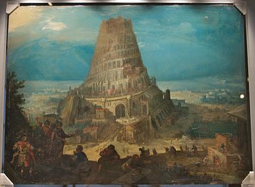
Imagine that you are an art dealer in Swinging Sixties London – 1962 to be precise. You manage to buy a bargain — an atmospheric early oil painting of the Tower of Babel, and intrigued, you decide to look on the back to see if you can find out more about this unsigned painting. A signature would add value to an already saleable thing.
Nimrod supervising the Construction of the Tower of Babel by Martin Van Valckenborgh 1559
So, you turn it over and are surprised to see it isn’t painted on a wooden panel as you had expected. Instead, it’s painted on an old copper plate, of the sort used by engravers. You rub at it with the cuff of your floral shirt, hoping to see a name. But a thumb over the surface reveals that the plate has already been used to print something else, and there does seem to be something very fine incised into it. So, curious, you get out your magnifying glass and peering through it, carefully clean the surface grime away with some methylated spirits.
The scene that appears seems to be a birds-eye view of people and houses. But there is writing too – all in reverse of course. Excited, you rush through to the bathroom and hold it up to a mirror. It reads ‘Fynnesburie Field’, and you see more detail, and what appear to be windmills. Finsbury Field – that’s right here in London! Closer scrutiny reveals men in Tudor costume practising archery, and women laying out their washing to dry. This could be an original Tudor plate, you realise. But what to do with it? You daren’t destroy the painting of the Tower of Babel, but this copper printing plate seems to be even earlier, and it would be a shame to keep it hidden from view.

The copper plate engraved by Frans Franken
In a ferment of excitement you hot-foot it to the London Museum to see if they can find out more.
And that is how we come to have the extraordinary “Copperplate” map of London. No copies of the printed map itself are known to have survived; but between 1962 and 1997 two more of the original plates were identified, both used as grounds for other paintings. It is lucky they were recycled in this way, or they could have been lost forever. The three plates cover the greater part of the built-up heart of Tudor London. The map can be precisely dated to between 1553 and 1559 because Coldharbour House was given to the Earl of Shrewsbury in 1553, and he re-named it Shrewsbury Place. St Paul’s Cathedral is shown with its spire which was burnt down in a fire in 1561. Also, nothing is shown of The Royal Exchange, which opened in 1571.
So here is the section showing Moorfields, and you can see the wonderful detail included by the Dutch artist who engraved it. I wonder if the person who commissioned it managed to find his way around London?

For more about the map, and to enlarge it, go here.
